Expert of the Week
Mohamed A. M. Abd Elbasit – Mapping the factors that affect the soil erosion, biodiversity and water resources
Feb 29th 2024

Mohamed Abd Elbasit has been a senior researcher at the Agricultural Research Council-Institute for soil, climate, water, geoinformation division since February 2015.
Mohamed obtained his Ph.D. degree in March 2009 in Bio-environmental Science, Tottori University, Japan.

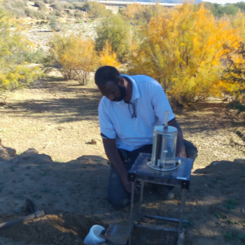
“My MSc and PhD research were focused on land degradation processes in arid and semi-arid environments. I worked on the impact of rainfall characteristics on soil erosion as an important source of sediment and sediment-associated pollutants in both agricultural and hillslope lands.”
He applied digital close-range photogrammetry techniques in order to monitor the soil surface deformation due to raindrop impact during the rainfall event.
In these studies, Mohamed utilized low cost camera-system to develop digital elevation model (DEM) for the soil surface with high resolution at different time steps. The rectified DEM was used to quantify the amount of sediment and to monitor the rills initiation on the soil surface as a major feature of the soil erosion.
“These topics introduced me to different experiences related to soil erosion quantification and various remote sensing and geographical information system techniques, programming experiences and modeling techniques.”
In April 2010, Mohamed started new project funded by the Japanese Society for the Promotion of Science (JSPS) to assess and simulate the future impact of soil and water conservation scenarios on land degradation status due to soil water erosion in the arid and semi-arid environment.
“The project was for two years during this period I worked on mapping the factors that affect the soil erosion and analyzing the spatiotemporal variability of each factor. These activities give knowledge on various GIS systems, spatial analysis, data management and variables regionalization.”
Also, during the same period, he started a new project on investigating the impact of the mesquite plant invasion on biodiversity and water resources in the arid and semi-arid environment of Sudan. The project was aimed to map the existence of mesquite plants and their impact on the groundwater.
In recent years, Mohamed has been leading bilateral funded project (NRF-JSPS) on the simulation the future scenarios of water quality under changing climate and land use.
“This in addition to my research activities in several projects related to crop estimation, dam siltation and land degradation mapping over South Africa.”
Solved is a platform and marketplace for sustainability-related knowledge work. Learn more and get started: www.solved.fi